NEBRASKAland
special eastern issue
December 1977 60 Cents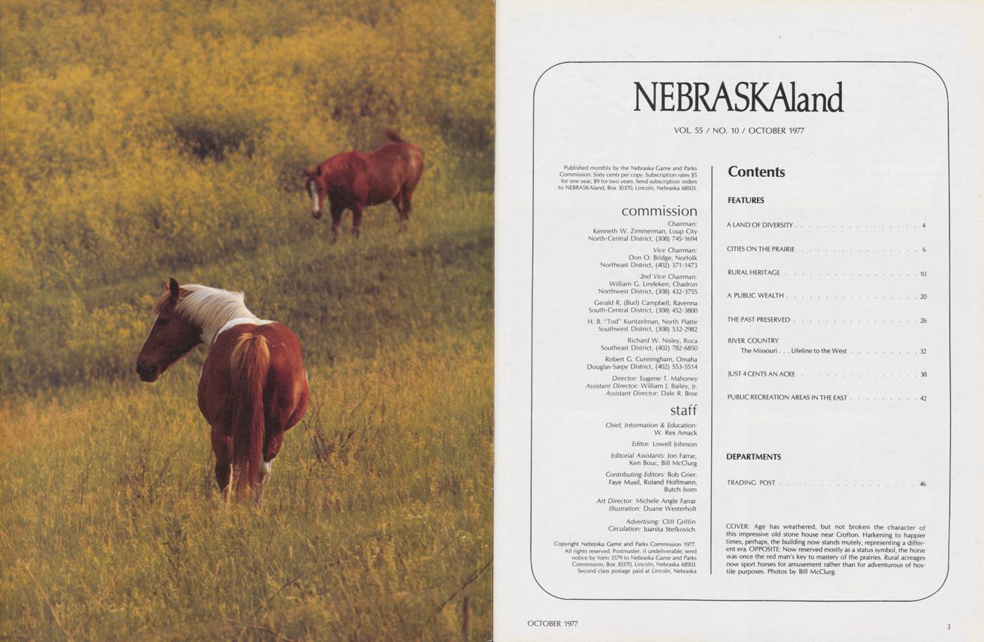
NEBRASKAland
VOL 55 / NO. 10 / OCTOBER 1977
Published monthly by the Nebraska Game and Parks Commission. Sixty cents per copy. Subscription rates $5 for one year, $9 for two years. Send subscription orders to NEBRASKAland, Box 30370, Lincoln, Nebraska 68503.
commission Chairman: Kenneth W. Zimmerman, Loup City North-Central District, (308) 745-1694 Vice Chairman: Don O. Bridge, Norfolk Northeast District, (402) 371-1473 2nd Vice Chairman: William G. Lindeken, Chadron Northwest District, (308) 432-3755 Gerald R. (Bud) Campbell, Ravenna South-Central District, (308) 452-3800 H. B. "Tod" Kuntzelman, North Platte Southwest District, (308) 532-2982 Richard W. Nisley, Roca Southeast District, (402) 782-6850 Robert G. Cunningham, Omaha Douglas-Sarpy District, (402) 553-5514 Director: Eugene T. Mahoney Assistant Director: William J. Bailey, Jr. Assistant Director: Dale R. Bree staff Chief, Information and Education: W. Rex Amack Editor: Lowell Johnson Editorial Assistants: Jon Farrar, Ken Bouc, Bill McClurg Contributing Editors: Bob Grier, Faye Musil, Roland Hoffmann, Butch Isom Art Director: Michele Angle Farrar Illustration: Duane Westerholt Advertising: Cliff Griffin Circulation: Juanita StefkovichCopyright Nebraska Game and Parks Commission 1977. All rights reserved. Postmaster: if undeliverable, send notice by form 3579 to Nebraska Game and Parks Commission, Box 30370, Lincoln, Nebraska 68503. Second class postage paid at Lincoln, Nebraska
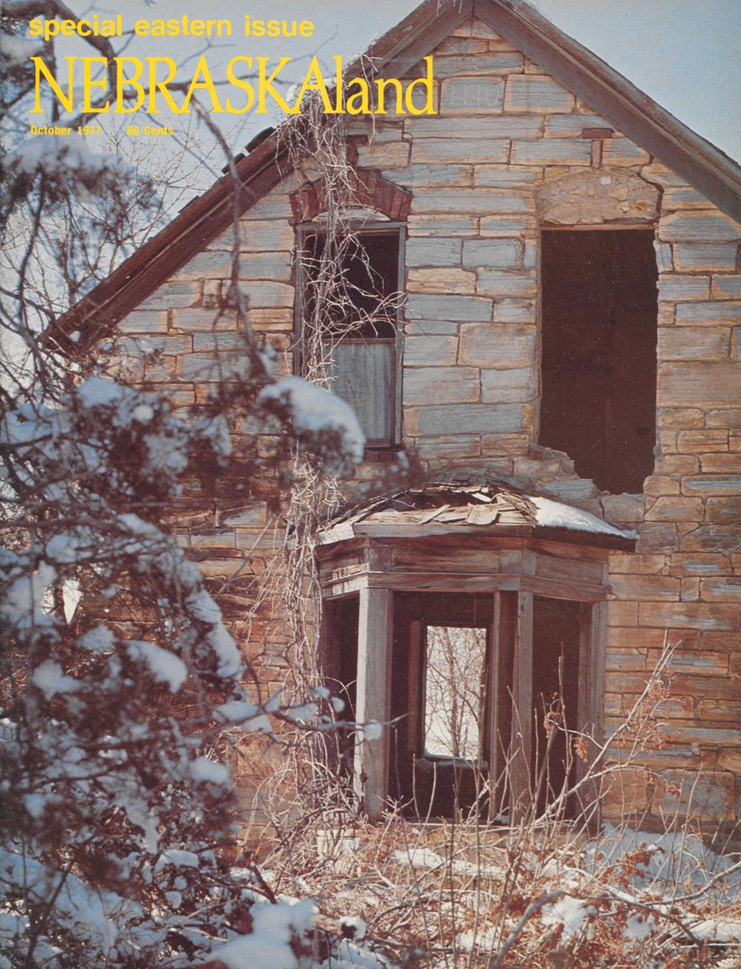
Contents FEATURES A LAND OF DIVERSITY 4 CITIES ON THE PRAIRIE 6 RURAL HERITAGE 10 A PUBLIC WEALTH 20 THE PAST PRESERVED 26 RIVER COUNTRY The Missouri. . . Lifeline to the West 32 JUST 4 CENTS AN ACRE 38 PUBLIC RECREATION AREAS IN THE EAST 42 DEPARTMENTS TRADING POST 46 COVER: Age has weathered, but not broken the character of this impressive old stone house near Crofton. Harkening to happier times, perhaps, the building now stands mutely, representing a different era. OPPOSITE: Now reserved mostly as a status symbol, the horse was once the red man's key to mastery of the prairies. Rural acreages now sport horses for amusement rather than for adventurous of hostile purposes. Photos by Bill McClurg. OCTOBER 1977 3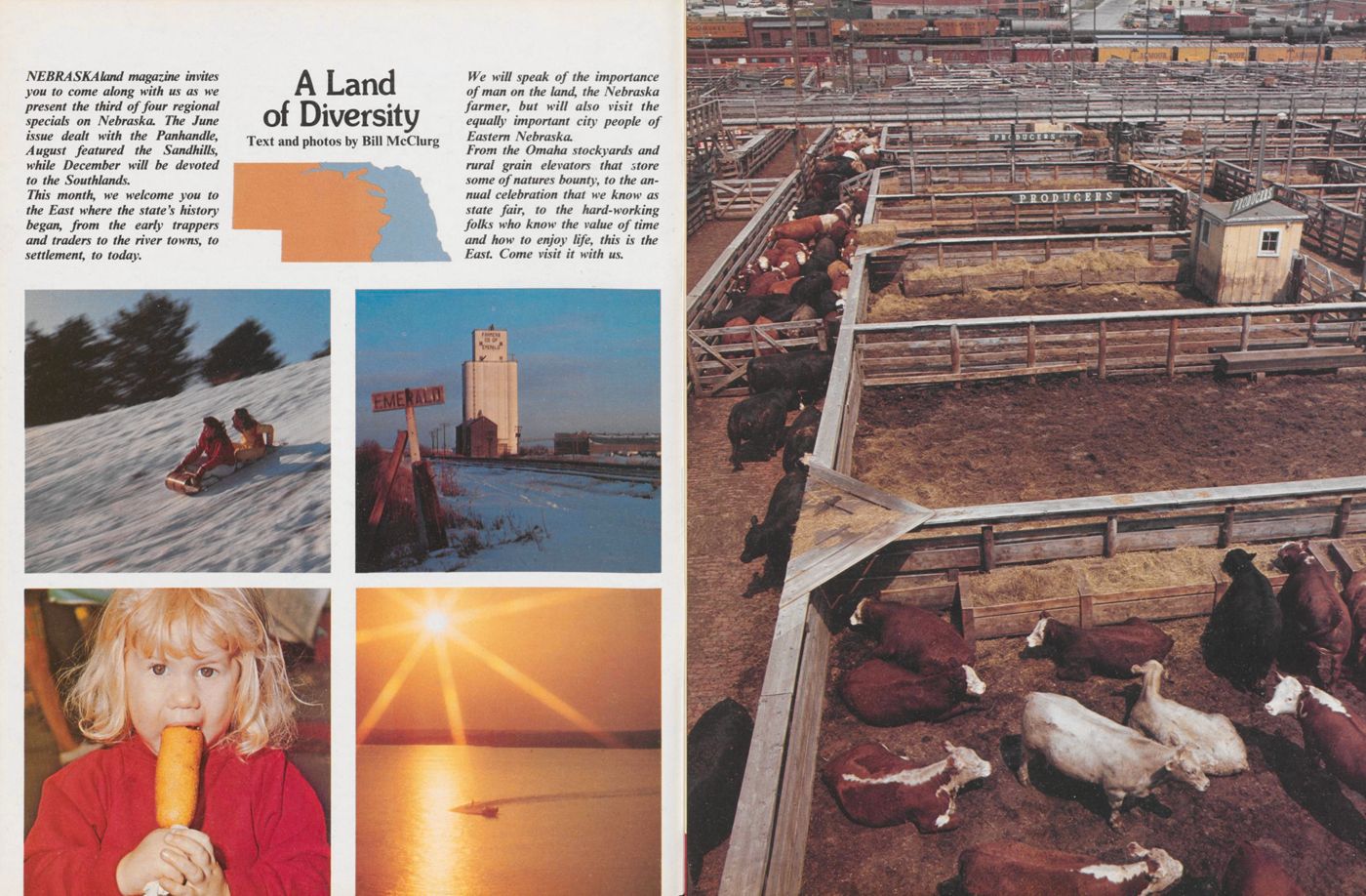
A Land of Diversity
Text amd Photos by Bill McClurgNEBRASKAland magazine invites you to come along with us as we present the third of four regional specials on Nebraska. The June issue dealt with the Panhandle, August featured the Sandhills, while December will be devoted to the Southlands.
This month, we welcome you to the East where the state's history began, from the early trappers and traders to the river towns, to settlement, to today.
We will speak of the importance of man on the land, the Nebraska farmer, but will also visit the equally important city people of Eastern Nebraska.
From the Omaha stockyards and rural grain elevators that store some of natures bounty, to the annual celebration that we know as state fair, to the hard-working folks who know the value of time and how to enjoy life, this is the East. Come visit it with us.
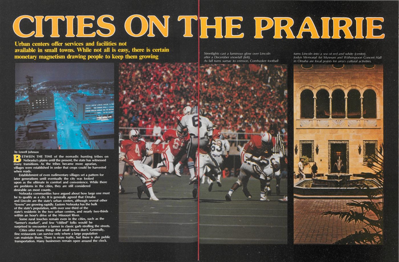
Cities on the Prairie
Urban centers offer services and facilities not available in small towns. While not all is easy, there is certain monetary magnetism drawing people to keep them growingBETWEEN THE TIME of the nomadic hunting tribes on Nebraska's plains until the present, the state has witnessed many transitions. As the tribes became more agrarian, villages were established in order that crops could be harvested when ready.
Establishment of even rudimentary villages set a pattern for later generations until eventually the city was looked upon as the ultimate in comfort and convenience. While there are problems in the cities, they are still considered desirable on most counts.
Nebraska communities have argued about how large one must be to qualify as a city. It is generally agreed that Omaha and Lincoln are the state's urban centers, although several other "towns" are growing rapidly. Eastern Nebraska has the bulk of the state's population, with over one-third of the state's residents in the two urban centers, and nearly two-thirds within an hour's drive of the Missouri River.
Some rural touches remain even in the cities, such as the "farmer's market", and few "citified" folks would be surprised to encounter a farmer in classic garb strolling the streets.
Cities offer many things that small towns don't. Generally, fine restaurants can survive only where a large population can maintain them. There is more traffic, but there is also public transportation. Many businesses remain open around the clock.
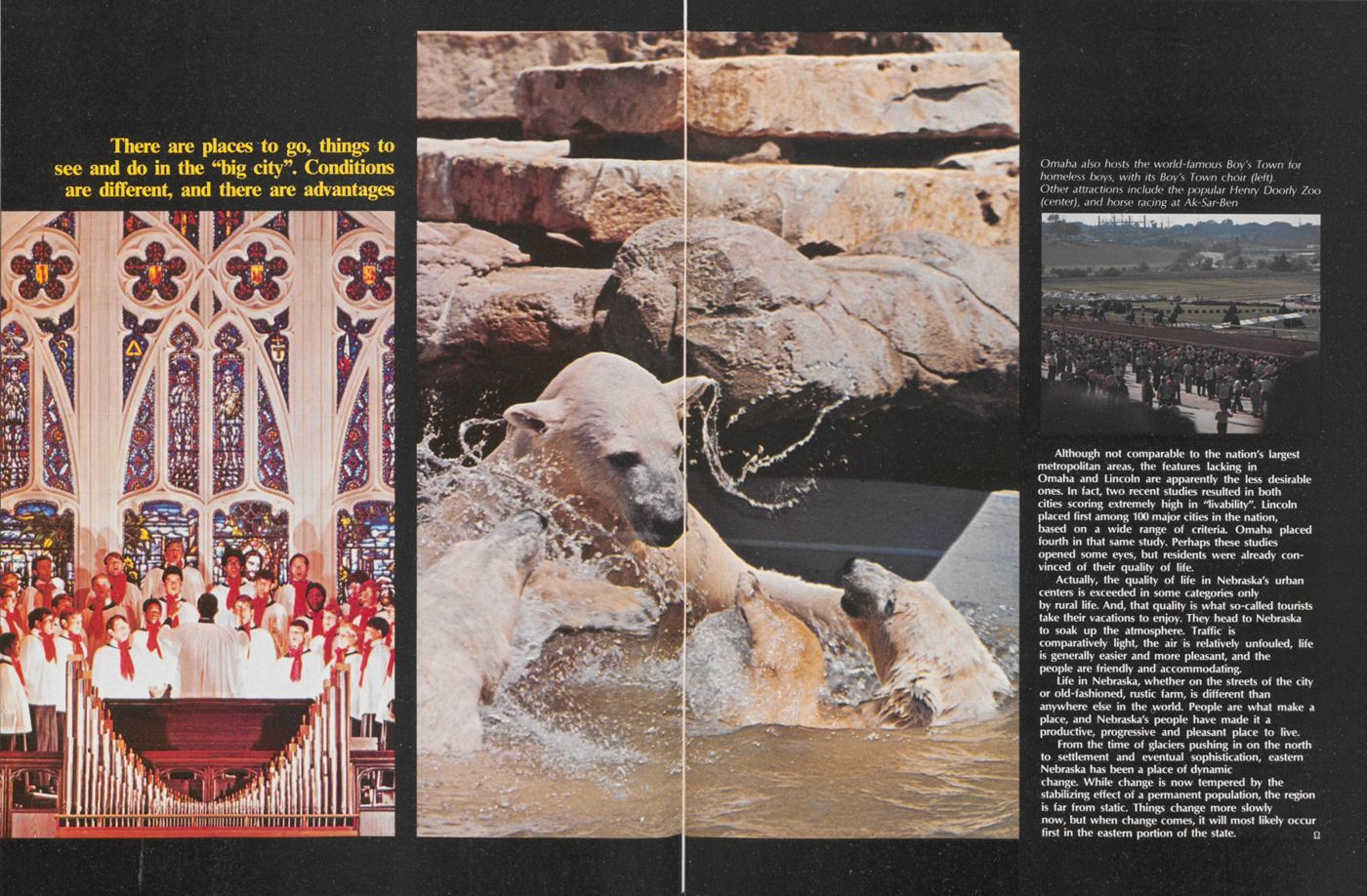
Although not comparable to the nation's largest metropolitan areas, the features lacking in Omaha and Lincoln are apparently the less desirable ones. In fact, two recent studies resulted in both cities scoring extremely high in "livability". Lincoln placed first among 100 major cities in the nation, based on a wide range of criteria. Omaha placed fourth in that same study. Perhaps these studies opened some eyes, but residents were already convinced of their quality of life.
Actually, the quality of life in Nebraska's urban centers is exceeded in some categories only by rural life. And, that quality is what so-called tourists take their vacations to enjoy. They head to Nebraska to soak up the atmosphere. Traffic is comparatively light, the air is relatively unfouled, life is generally easier and more pleasant, and the people are friendly and accommodating.
Life in Nebraska, whether on the streets of the city or old-fashioned, rustic farm, is different than anywhere else in the world. People are what make a place, and Nebraska's people have made it a productive, progressive and pleasant place to live.
From the time of glaciers pushing in on the north to settlement and eventual sophistication, eastern Nebraska has been a place of dynamic change. While change is now tempered by the stabilizing effect of a permanent population, the region is far from static. Things change more slowly now, but when change comes, it will most likely occur first in the eastern portion of the state.
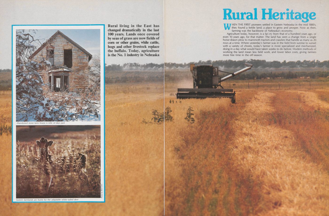
Rural Heritage
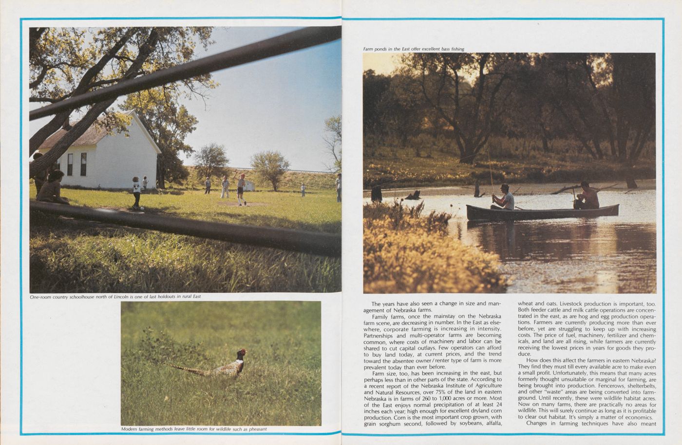
WHEN THE FIRST pioneers settled in Eastern Nebraska in the mid 1800's, they found a fertile land; a place to grow and prosper. Now as then, farming was the backbone of Nebraska's economy.
Agriculture today, however, is a far cry from that of a hundred years ago, or even 10 years ago, for that matter. The land has seen a change from a single horse-drawn plow to mammoth tractors and crawlers that handle as many as 20 rows at a time. Where yesterday's farmer was in the field from sunrise to sunset with a variety of chores, today's farmer is more specialized and mechanized, doing in a day what would have taken weeks to do before. Modern methods of working the land mean less field work, and lower labor costs, giving farmers more free time in the off-season.
The years have also seen a change in size and management of Nebraska farms.
Family farms, once the mainstay on the Nebraska farm scene, are decreasing in number. In the East as elsewhere, corporate farming is increasing in intensity. Partnerships and multi-operator farms are becoming common, where costs of machinery and labor can be shared to cut capital outlays. Few operators can afford to buy land today, at current prices, and the trend toward the absentee owner/renter type of farm is more prevalent today than ever before.
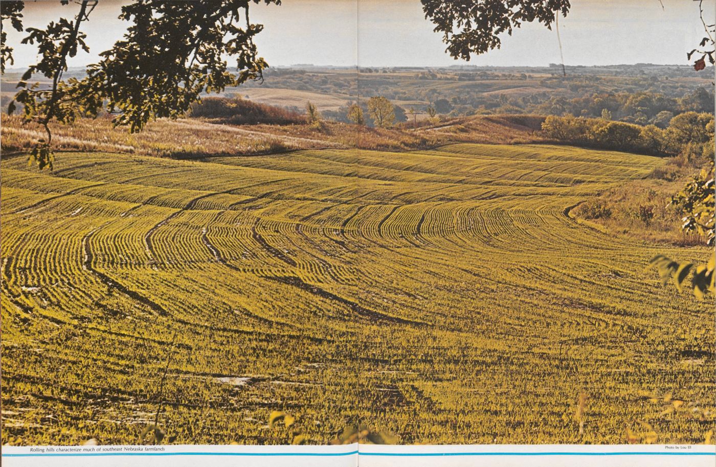
Farm size, too, has been increasing in the east, but perhaps less than in other parts of the state. According to a recent report of the Nebraska Institute of Agriculture and Natural Resources, over 75% of the land in eastern Nebraska is in farms of 260 to 1,000 acres or more. Most of the East enjoys normal precipitation of at least 24 inches each year; high enough for excellent dryland corn production. Corn is the most important crop grown, with grain sorghum second, followed by soybeans, alfalfa, wheat and oats. Livestock production is important, too. Both feeder cattle and milk cattle operations are concentrated in the east, as are hog and egg production operations. Farmers are currently producing more than ever before, yet are struggling to keep up with increasing costs. The price of fuel, machinery, fertilizer and chemicals, and land are all rising, while farmers are currently receiving the lowest prices in years for goods they produce.
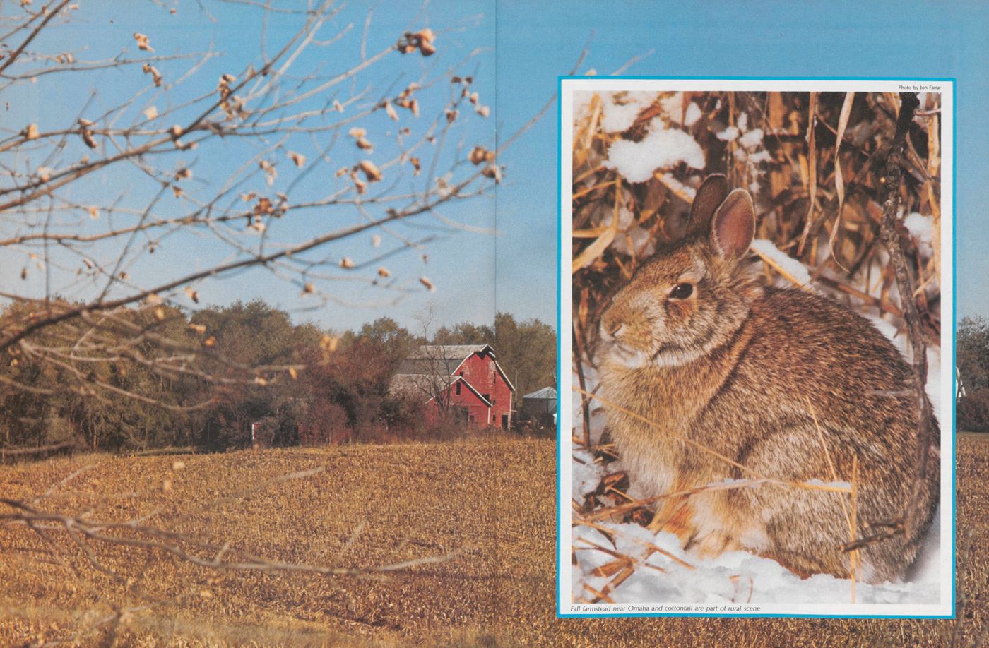
How does this affect the farmers in eastern Nebraska? They find they must till every available acre to make even a small profit. Unfortunately, this means that many acres formerly thought unsuitable or marginal for farming, are being brought into production. Fencerows, shelterbelts, and other "waste" areas are being converted into farmground. Until recently, these were wildlife habitat acres. Now on many farms, there are practically no areas for wildlife. This will surely continue as long as it is profitable to clear out habitat. It's simply a matter of economics.
Changes in farming techniques have also meant
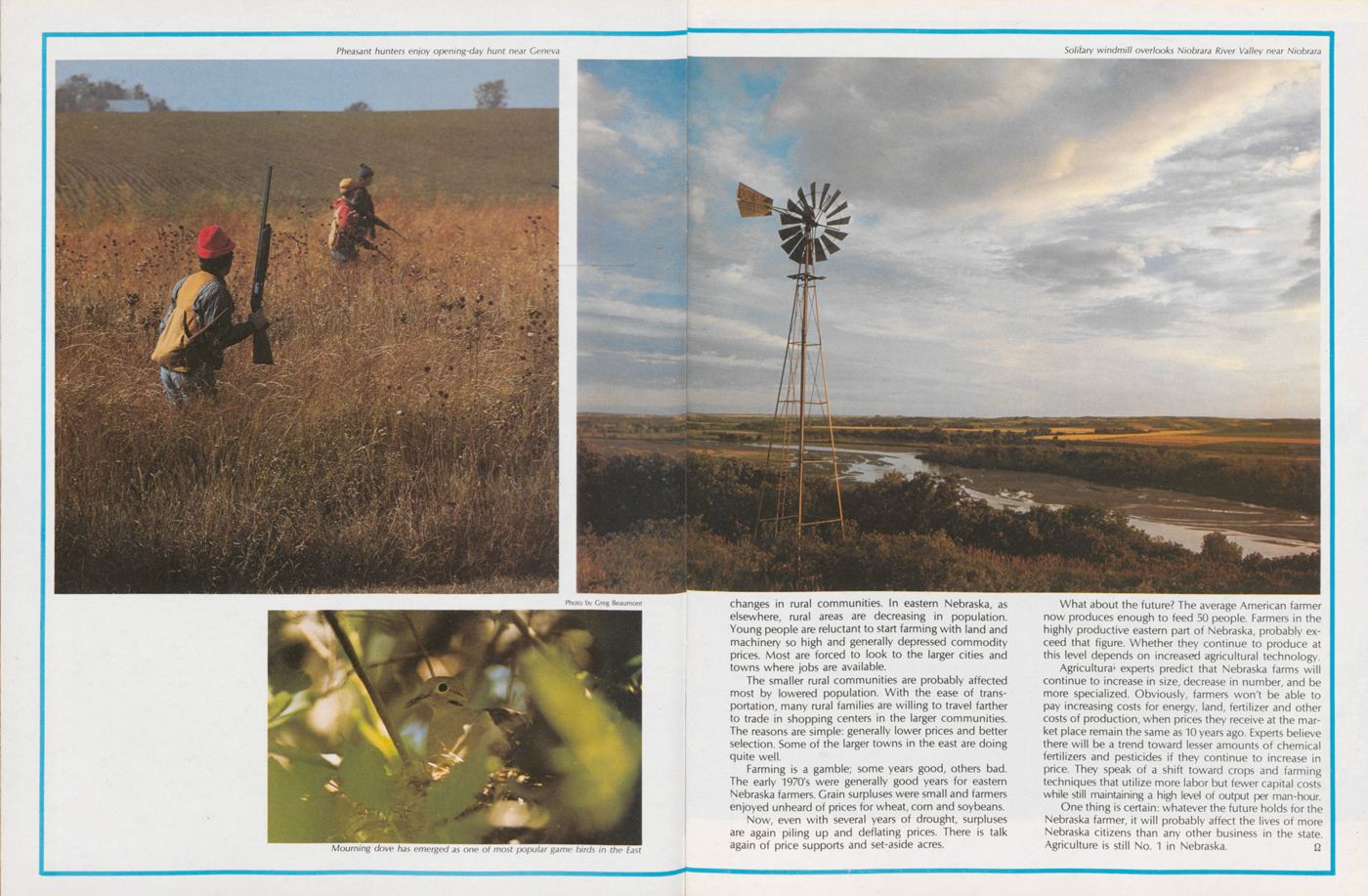
changes in rural communities. In eastern Nebraska, as elsewhere, rural areas are decreasing in population. Young people are reluctant to start farming with land and machinery so high and generally depressed commodity prices. Most are forced to look to the larger cities and towns where jobs are available.
The smaller rural communities are probably affected most by lowered population. With the ease of transportation, many rural families are willing to travel farther to trade in shopping centers in the larger communities. The reasons are simple: generally lower prices and better selection. Some of the larger towns in the east are doing quite well.
Farming is a gamble; some years good, others bad. The early 1970's were generally good years for eastern Nebraska farmers. Grain surpluses were small and farmers enjoyed unheard of prices for wheat, corn and soybeans.
Now, even with several years of drought, surpluses are again piling up and deflating prices. There is talk again of price supports and set-aside acres.
What about the future? The average American farmer now produces enough to feed 50 people. Farmers in the highly productive eastern part of Nebraska, probably exceed that figure. Whether they continue to produce at this level depends on increased agricultural technology.
Agricultura' experts predict that Nebraska farms will continue to increase in size, decrease in number, and be more specialized. Obviously, farmers won't be able to pay increasing costs for energy, land, fertilizer and other costs of production, when prices they receive at the market place remain the same as 10 years ago. Experts believe there will be a trend toward lesser amounts of chemical fertilizers and pesticides if they continue to increase in price. They speak of a shift toward crops and farming techniques that utilize more labor but fewer capital costs while still maintaining a high level of output per man-hour.
One thing is certain: whatever the future holds for the Nebraska farmer, it will probably affect the lives of more Nebraska citizens than any other business in the state. Agriculture is still No. 1 in Nebraska.
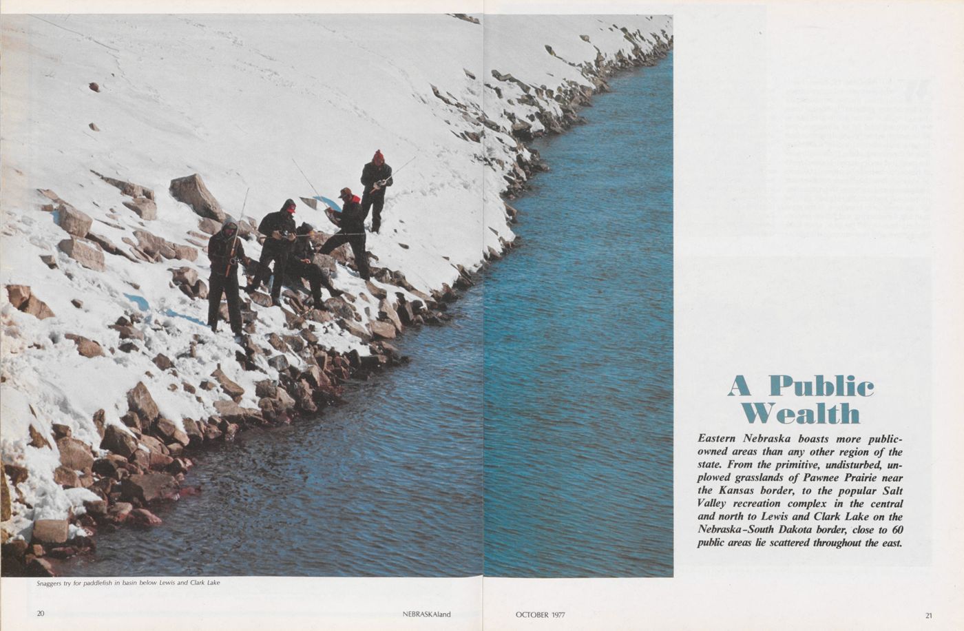
A Public Wealth
Eastern Nebraska boasts more public-owned areas than any other region of the state. From the primitive, undisturbed, unplowed grasslands of Pawnee Prairie near the Kansas border, to the popular Salt Valley recreation complex in the central and north to Lewis and Clark Lake on the Nebraska-South Dakota border, close to 60 public areas lie scattered throughout the east 21 OCTOBER 1977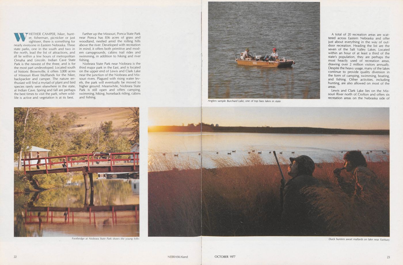
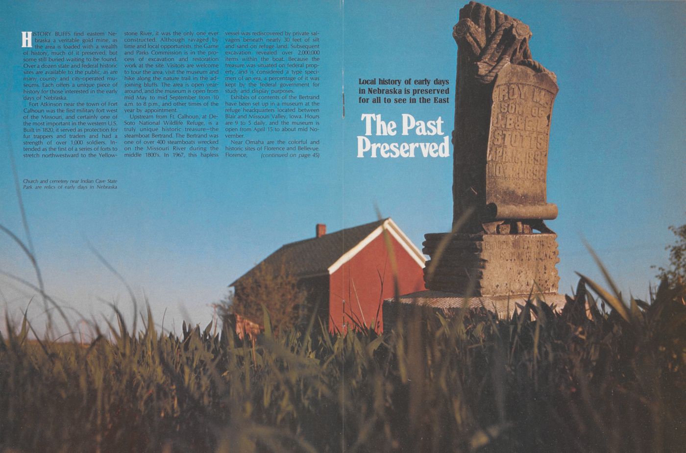
WHETHER CAMPER, hiker, hunter, fisherman, picnicker or just sightseer, there is something for nearly everyone in Eastern Nebraska. Three state parks, one in the south and two in the north, lead the list of attractions, and all lie within a few hours of metropolitan Omaha and Lincoln. Indian Cave State Park is the newest of the three, and is for the most part undeveloped. Located south of historic Brownville, it offers 3,000 acres of Missouri River blufflands for the hiker, backpacker and camper. The nature enthusiast will find a myriad of plant and bird species rarely seen elsewhere in the state, at Indian Cave. Spring and fall are perhaps the best times to visit the park, when wildlife is active and vegetation is at its best.
Farther up the Missouri, Ponca State Park near Ponca has 836 acres of grass and woodland, nestled amid the rolling hills above the river. Developed with recreation in mind, it offers both primitive and modern campgrounds, cabins trail rides and swimming, in addition to hiking and river fishing.
Niobrara State Park near Niobrara is the third major park in the East, and is located on the upper end of Lewis and Clark Lake near the junction of the Niobrara and Missouri rivers. Plagued with rising water levels, the park will eventually be moved to higher ground. Meanwhile, Niobrara State Park is still open and offers camping, swimming, hiking, horseback riding, cabins and fishing.
A total of 20 recreation areas are scattered across Eastern Nebraska and offer just about everything in the way of outdoor recreation. Heading the list are the seven of the Salt Valley Lakes. Located within an hour of at least a third of the state's population, they are perhaps the most heavily used of recreation areas, drawing over 2 million visitors annually. Despite the heavy usage, many of the lakes continue to provide quality diversion in the form of camping, swimming, boating, and fishing. Other activities, including hunting, are also allowed on most of the areas.
Lewis and Clark Lake lies on the Missouri River north of.Crofton and offers six recreation areas on the Nebraska side of
OCTOBER 1977 23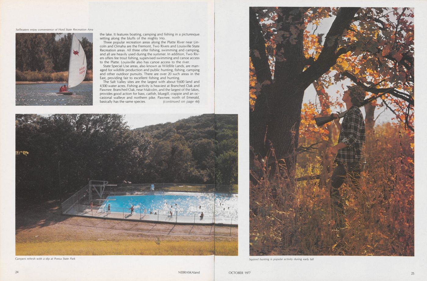
the lake. It features boating, camping and fishing in a picturesque setting along the bluffs of the mighty Mo.
Three popular recreation areas along the Platte River near Lincoln and Omaha are the Fremont, Two Rivers and Louisville State Recreation areas. All three offer fishing, swimming and camping, and all are heavily used during the summer. In addition, Two Rivers offers fee trout fishing, supervised swimming and canoe access to the Platte. Louisville also has canoe access to the river.
State Special Use areas, also known as Wildlife Lands, are managed for wildlife production and public hunting, fishing, camping and other outdoor pursuits. There are over 20 such areas in the East, providing fair to excellent fishing and hunting.
The Salt Valley sites are the largest with about 9,600 land and 4,500 water acres. Fishing activity is heaviest at Branched Oak and Pawnee. Branched Oak, near Malcolm, and the largest of the lakes, provides good action for bass, catfish, bluegill, crappie and an occasional walleye and northern pike. Pawnee, north of Emerald, basically has the same species. (continued on page 44)
The Past Preserved
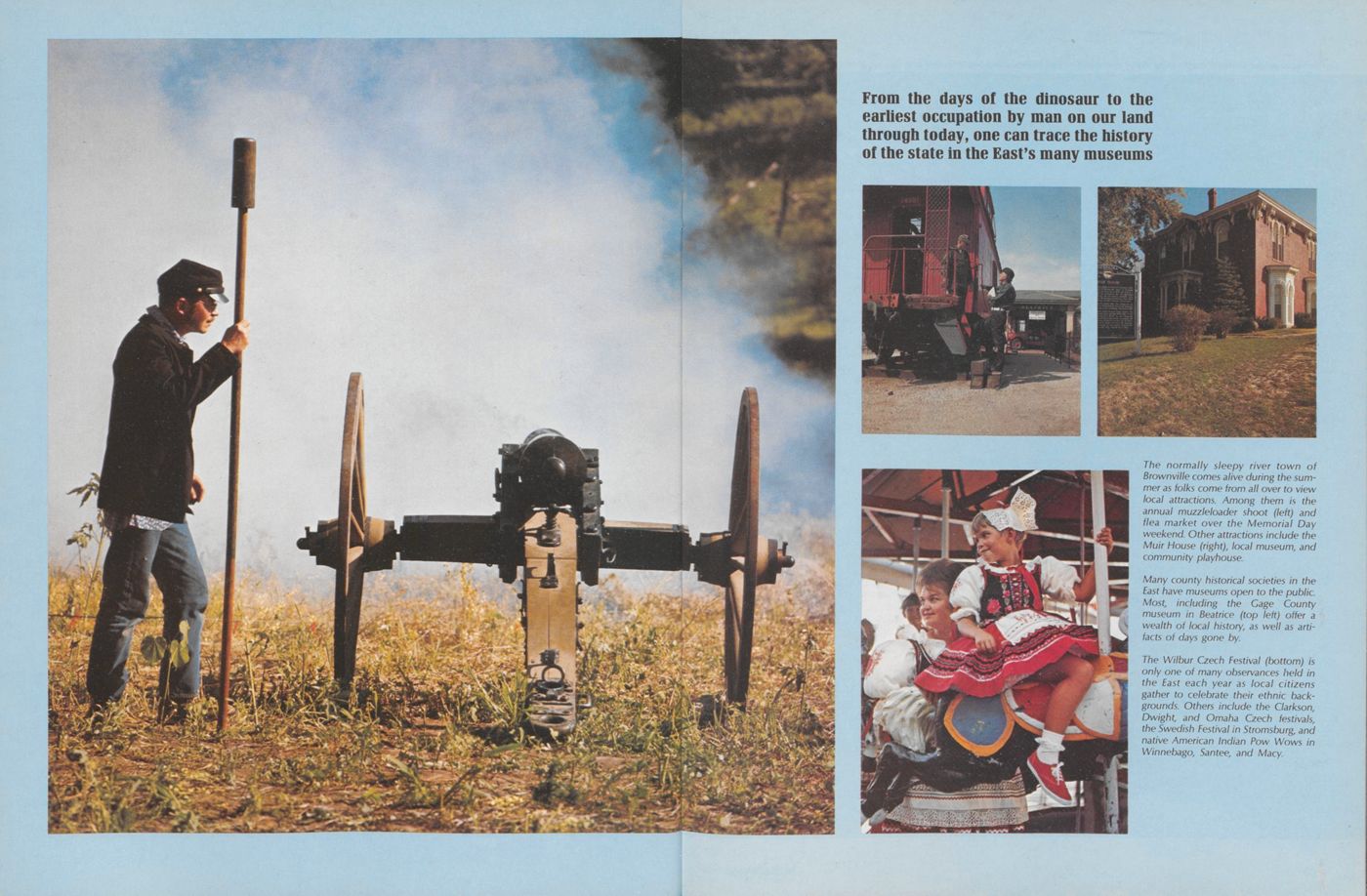
Local history of early days in Nebraska is preserved for all to see in the EastHISTORY BUFFS find eastern Nebraska a veritable gold mine, as the area is loaded with a wealth of history, much of it preserved, but some still buried waiting to be found. Over a dozen state and federal historic sites are available to the public, as are many county and city-operated museums. Each offers a unique piece of history for those interested in the early days of Nebraska.
Fort Atkinson near the town of Fort Calhoun was the first military fort west of the Missouri, and certainly one of the most important in the western U.S. Built in 1820, it served as protection for fur trappers and traders and had a strength of over 1,000 soldiers. Intended as the first of a series of forts to stretch northwestward to the Yellowstone River, it was the only one ever constructed. Although ravaged by time and local opportunists, the Game and Parks Commission is in the process of excavation and restoration work at the site. Visitors are welcome to tour the area, visit the museum and hike along the nature trail in the adjoining bluffs. The area is open yeararound, and the museum is open from mid May to mid September from 10 a.m. to 8 p.m., and other times of the year by appointment.
Upstream from Ft. Calhoun, at DeSoto National Wildlife Refuge, is a truly unique historic treasure—the steamboat Bertrand. The Bertrand was one of over 400 steamboats wrecked on the Missouri River during the middle 1800's. In 1967, this hapless vessel was rediscovered by private salvagers beneath nearly 30 feet of silt and sand on refuge land. Subsequent excavation revealed over 2,000,000 items within the boat. Because the treasure was situated on federal property, and is considered a type specimen of an era, a percentage of it was kept by the federal government for study and display purposes.
Exhibits of contents of the Bertrand have been set up in a museum at the refuge headquarters located between Blair and Missouri Valley, Iowa. Hours are 9 to 5 daily, and the museum is open from April 15 to about mid November.
Near Omaha are the colorful and historic sites of Florence and Bellevue. Florence, (continued on page 45)
RIVER COUNTRY
The Missouri-Lifeline to the West
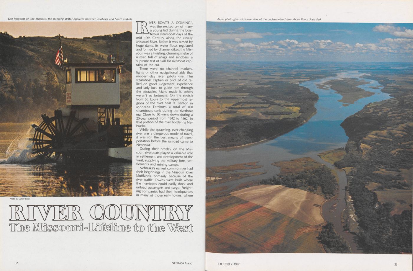
RIVER BOAT'S A COMING", was the excited cry of many a young lad during the boisterous steamboat days of the mid 19th Century along the unruly Missouri River. Before it was tamed by huge dams, its water flows regulated and formed by channel dikes, the Missouri was a twisting, churning snake of a river, full of snags and sandbars; a supreme test of skill for riverboat captains of the era.
There were no channel markers, lights or other navigational aids that modern-day river pilots use. The steamboat captain or pilot of old relied on good judgement, experience and lady luck to guide him through the obstacles. Many made it, others weren't so fortunate. On the stretch from St. Louis to the uppermost regions of the river near Ft. Benton in Montana Territory, a total of 400 steamboats sank during the riverboat era. Close to 60 went down during a 20-year period from 1842 to 1862, in that portion of the river bordering Nebraska.
While the sprawling, ever-changing river was a dangerous mode of travel, it was still the best means of transportation before the railroad came to Nebraska.
During their heyday on the Missouri, riverboats played a valuable role in settlement and development of the west, supplying the military forts, settlements and mining camps.
Nebraska's earliest communities had their beginnings in the Missouri River blufflands, primarily because of the river traffic. Towns were built where the riverboats could easily dock and unload passengers and cargo. Freighting companies had their headquarters in many of those early towns, where
32 NEBRASKAland
they loaded settlers and their belongings onto wagons for the long, dangerous trip overland to California, Oregon and Utah.
Towns with names like Nebraska City, Brownville, and Bellevue are just a few of the colorful, bustling early boom towns that originated with the river trade and which still exist. Other settlements with names like Aspinwall, Wyoming, St. Deroin, St. Stephens, Hillsdale, and many others are gone forever, doomed when river traffic dwindled and others got the railroads.
With progress come many kinds of change, and as the country became settled, it was obvious that man would no longer tolerate the river's sometimes wild, uncontrolled meanderings. Efforts to subdue the river began in the late 1800's with bank stabilization and snag removal, but serious efforts didn't come about until the 1940's when the U.S. Army Corps of Engineers began to regulate the river flows for flood control, power generation, and navigation. Channelization of the Missouri begins at Ponca, Nebraska and stretches downstream to the mouth of the river near St. Louis, Missouri. Today's river-
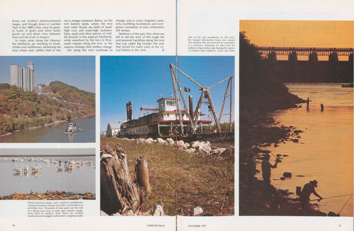
boats are modern diesel-powered barges, and though fewer in number than in the 1880's, they carry far greater loads of grain and other bulky goods up and down river, between here and the Gulf of Mexico.
In many areas along the Missouri the blufflands are reverting to brush, timber and wildflowers, reclaiming the land where early settlers tried to eke out a meager existence. Below, on the rich bottom lands, where the river now rarely floods, are fields of headhigh corn and waist-high soybeans. Deer, quail and other species of wildlife flourish in the adjacent blufflands, while waterfowl by the tens of thousands migrate along the river, as the seasons undergo their endless change.
Life along the river continues to change, and in many forgotten areas, only crumbling foundations and overgrown cemeteries of early settlements still remain.
Skeletons of the past, they alone are left to tell the story of the rough life and personal hardships along the river that was called Big Muddy; the river that served for many years as the virtual lifeline to the west.
Just 4¢ an Acre
For that small sum, the Louisiana Purchase made Nebraska part of U.S. and opened way West
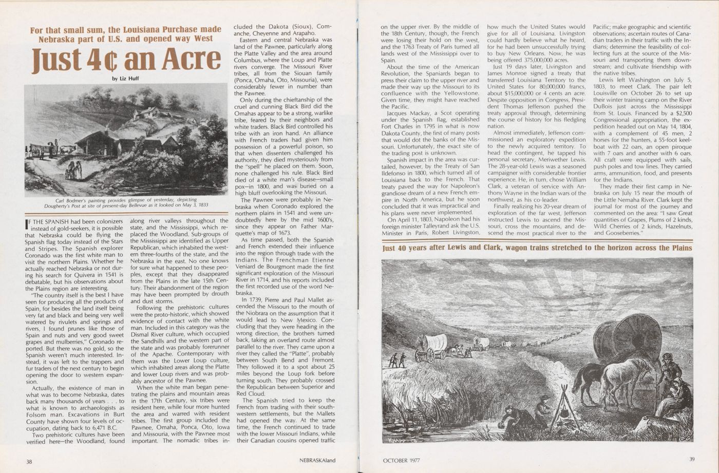
IF THE SPANISH had been colonizers instead of gold-seekers, it is possible that Nebraska could be flying the Spanish flag today instead of the Stars and Stripes. The Spanish explorer Coronado was the first white man to visit the northern Plains. Whether he actually reached Nebraska or not during his search for Quivera in 1541 is debatable, but his observations about the Plains region are interesting.
"The country itself is the best I have seen for producing all the products of Spain, for besides the land itself being very fat and black and being very well watered by rivulets and springs and rivers, I found prunes like those of Spain and nuts and very good sweet grapes and mulberries," Coronado reported. But there was no gold, so the Spanish weren't much interested. Instead, it was left to the trappers and fur traders of the next century to begin opening the door to western expansion.
Actually, the existence of man in what was to become Nebraska, dates back many thousands of years ... to what is known to archaeologists as Folsom man. Excavations in Burt County have shown four levels of occupation, dating back to 6,471 B.C.
Two prehistoric cultures have been verified here-the Woodland, found along river valleys throughout the state, and the Mississippi, which replaced the Woodland. Sub-groups of the Mississippi are identified as Upper Republican, which inhabited the western three-fourths of the state, and the Nebraska in the east. No one knows for sure what happened to these peoples, except that they disappeared from the Plains in the late 15th Century. Their abandonment of the region may have been prompted by drouth and dust storms.
Following the prehistoric cultures were the proto-historic, which showed evidence of contact with the white man. Included in this category was the Dismal River culture, which occupied the Sandhills and the western part of the state and was probably forerunner of the Apache. Contemporary with them was the Lower Loup culture, which inhabited areas along the Platte and lower Loup rivers and was probably ancestor of the Pawnee.
When the white man began penetrating the plains and mountain areas in the 17th Century, six tribes were resident here, while four more hunted the area and warred with resident tribes. The first group included the Pawnee, Omaha, Ponca, Oto, Iowa and Missouria, with the Pawnee most important. The nomadic tribes included the Dakota (Sioux), Comanche, Cheyenne and Arapaho.
Eastern and central Nebraska was land of the Pawnee, particularly along the Platte Valley and the area around Columbus, where the Loup and Platte rivers converge. The Missouri River tribes, all from the Siouan family (Ponca, Omaha, Oto, Missouria), were considerably fewer in number than the Pawnee.
Only during the chieftanship of the cruel and cunning Black Bird did the Omahas appear to be a strong, warlike tribe, feared by their neighbors and white traders. Black Bird controlled his tribe with an iron hand. An alliance with French traders had given him possession of a powerful poison, so that when dissenters challenged his authority, they died mysteriously from the "spell" he placed on them. Soon, none challenged his rule. Black Bird died of a white man's disease-small pox-in 1800, and was- buried on a high bluff overlooking the Missouri.
The Pawnee were probably in Nebraska when Coronado explored the northern plains in 1541 and were undoubtedly here by the mid 1600's, since they appear on Father Marquette's map of 1673.
As time passed, both the Spanish and French extended their influence into the region through trade with the Indians. The Frenchman Etienne Veniard de Bourgmont made the first significant exploration of the Missouri River in 1714, and his reports included the first recorded use of the word Nebraska.
In 1739, Pierre and Paul Mallet ascended the Missouri to the mouth of the Niobrara on the assumption that it would lead to New Mexico. Concluding that they were heading in the wrong direction, the brothers turned back, taking an overland route almost parallel to the river. They came upon a river they called the "Platte", probably between South Bend and Fremont. They followed it to a spot about 25 miles beyond the Loup fork before turning south. They probably crossed the Republican between Superior and Red Cloud.
The Spanish tried to keep the French from trading with their southwestern settlements, but the Mallets had opened the way. At the same time, the French continued to trade with the lower Missouri Indians, while their Canadian cousins opened traffic
38 NEBRASKAlandon the upper river. By the middle of the 18th Century, though, the French were losing their hold on the west, and the 1763 Treaty of Paris turned all lands west of the Mississippi over to Spain.
About the time of the American Revolution, the Spaniards began to press their claim to the upper river and made their way up the Missouri to its confluence with the Yellowstone. Given time, they might have reached the Pacific.
Jacques Mackay, a Scot operating under the Spanish flag, established Fort Charles in 1795 in what is now Dakota County, the first of many posts that would dot the banks of the Missouri. Unfortunately, the exact site of the trading post is unknown.
Spanish impact in the area was curtailed, however, by the Treaty of San lldefonso in 1800, which turned all of Louisiana back to the French. That treaty paved the way for Napoleon's grandiose dream of a new French empire in North America, but he soon concluded that it was impractical and his plans were never implemented.
On April 11,1803, Napoleon had his foreign minister Talleyrand ask the U.S. Minister in Paris, Robert Livingston, how much the United States would give for all of Louisiana. Livingston could hardly believe what he heard, for he had been unsuccessfully trying to buy New Orleans. Now, he was being offered 375,000,000 acres.
Just 19 days later, Livingston and James Monroe signed a treaty that transferred Louisiana Territory to the United States for 80,000,000 francs, about $15,000,000 or 4 cents an acre. Despite opposition in Congress, President Thomas Jefferson pushed the treaty approval through, determining the course of history for his fledgling nation.
Almost immediately, Jefferson commissioned an exploratory expedition to the newly acquired territory. To head the contingent, he tapped his personal secretary, Meriwether Lewis. The 28-year-old Lewis was a seasoned campaigner with considerable frontier experience. He, in turn, chose William Clark, a veteran of service with Anthony Wayne in the Indian wars of the northwest, as his co-leader.
Finally realizing his 20-year dream of exploration of the far west, Jefferson instructed Lewis to ascend the Missouri, cross the mountains, and descend the most practical river to the Pacific; make geographic and scientific observations; ascertain routes of Canadian traders in their traffic with the Indians; determine the feasibility of collecting furs at the source of the Missouri and transporting them downstream; and cultivate friendship with the native tribes.
Lewis left Washington on July 5, 1803, to meet Clark. The pair left Louisville on October 26 to set up their winter training camp on the River DuBois just across the Mississippi from St. Louis. Financed by a $2,500 Congressional appropriation, the expedition headed out on May 14,1804, with a complement of 45 men, 2 horses for the hunters, a 55-foot keelboat with 22 oars, an open piroque with 7 oars and another with 6 oars. All craft were equipped with sails, push poles and tow lines. They carried arms, ammunition, food, and presents for the Indians.
They made their first camp in Nebraska on July 15 near the mouth of the Little Nemaha River. Clark kept the journal for most of the journey and commented on the area: "I saw Great quantities of Grapes, Plums of 2 kinds, Wild Cherries of 2 kinds, Hazelnuts, and Gooseberries."
In all, Lewis and Clark spent until September 7 along the Nebraska shore on their outward trek. They moved on to the Platte River where they set up camp on July 21. The next day, they proceeded 10 miles up the Platte and decided to spend a few days at a spot they dubbed "Camp White Catfish" to explore the country and try to persuade the Indians to come in for a parley. At that point, one of the contingent (a Frenchman named Liberte) was sent to contact the Oto, but deserted. So did a Private Reed, but he was recaptured later.
Lewis and Clark finally met with the Otos and Missourias on August 3 some 50 miles upstream at a point they called "Council Bluff", near the present site of Fort Calhoun. Commenting on the area in their log, Clark noted that it appeared to be a "verry proper place for a Tradeing establishment and fortification."
A few days later, the expedition stopped at Blackbird Hill. They found the former chief's grave and placed a flag on it. Continuing upriver, they made camp near Homer, where they caught over 400 fish with a makeshift seine in Omaha Creek. All together, they set up camp at 17 sites in Nebraska, plus several on the Iowa side of the river.
Leaving Nebraska on September 8, they proceeded on north. They wintered with the Mandan Indians near Bismarck, N.D., and set out again on April 7,1805. After much hardship they came in sight of the Pacific on November 7. They had reached the "Western Sea", but unfortunately it was a poor route. Other explorers would eventually find a better way to the Pacific, but their monumental achievement pointed the way. They had pried open the doorway to the West.
Even before Lewis and Clark got back, Lt. Zebulon Pike left with an expedition to explore the southwest. His route touched southern Nebraska, where he visited the Pawnee. After being captured and released by the Spaniards, Pike returned to report on his travels. Unfortunately, his comments about the Great Plains were far from complimentary, referring to the region as a vast desert. His remarks had a great impact back east and were at least partially responsible for slowing settlement of the area.
While Pike was writing his reports in 1807, Manuel Lisa left St. Louis with a keelboat of trade goods. He met John Colter, who had been with Lewis and Clark, at the mouth of the Platte and persuaded him to go back up river. There they set up a successful fur trade. In 1809, Lisa set up the Missouri Fur Company to expand the trade, but was unsuccessful. With the company reorganized in 1812, pressure from the British and Indians forced Lisa to abandon the upper river. He retreated to a point near Council Bluff where he built a new post, Fort Lisa, near present-day Bellevue. It soon became the most important on the Missouri River, as the post controlled trade with the Omaha, Pawnee and Oto. His marriage to an Omaha Indian cemented his relationship with the tribes. With his death in 1820, Joshua Pilcher took over the company and withdrew from all upriver trade, leaving the field open to the growing power of John Jacob Astor's American Fur Company.
Slowed by the War of 1812, the next sanctioned expedition did not go up the Missouri until 1819, when the Yellowstone Expedition under Col. Henry Atkinson and Maj. Stephen H. Long set out. Atkinson's military force of 1,126 men was to set up a string of
forts, while Long's scientic party proceeded with surveys. Unlike previous excursions, they turned to steam for their journey. Atkinson's force had trouble. Of five boats, two never entered the river, a third was abandoned in Missouri, and the other two stopped below the mouth of the Kansas. He was lucky to reach Council Bluff by winter. Long's party had better fortunes. His unusual steamer, the "Western Engineer", was better suited to the river. It had a lighter draft and was a stern-wheeler, probably the first ever built. It became the first steamboat to ascend the Missouri River as far as Council Bluff.
Atkinson's troops spent a miserable, scurvy-ridden winter at Camp Missouri, established in the bottoms below Council Bluff, while Long's force did somewhat better at Engineer Cantonment some five miles downstream. In the spring, word came that funds had been cut, and Atkinson was to proceed no farther but complete the outpost there. It would be the nation's bulwark of northwest defense.
Long's contingent of 20 men left on June 6, 1820, and followed the Platte River route to the Rockies. While not particularly successful, his reports reinforced Pike's opinions of the plains. He termed the country "wholly unfit for cultivation and of course uninhabitable by people depending upon agriculture for their subsistence." Settlement was slow in coming as a result of Long and Pike.
Meanwhile, the 6th Infantry moved to higher ground and transformed Camp Missouri into a permanent installation named Fort Atkinson. Trouble wasn't long in coming, and Atkinson served as the base of operations for General Leavenworth's cam- paign against the Ankara in South Dakota in 1823. Basically, though, things were relatively quiet at Atkinson, and the soldiers proceeded with a number of agricultural experiments. Those experiments didn't impress Army Inspector George Croghan, and he called Atkinson the weakest fort and worst-trained garrison he'd ever seen. Soon thereafter (June 1827), Fort Atkinson was abandoned.
In the spring of 1824, Thomas Fitzpatrick and James Clyman followed the Platte from the mountains to the Missouri, reporting rich beaver grounds on the Green River. That prompted General William Ashley to organize an expedition to the Rockies via the Platte, leaving Fort Atkinson on November 3,1824 with 25 men, 50 pack horses and a wagon. Even before Fitzpatrick and Clyman, Robert Stuart went through the Platte Valley (1813) and reported its potential as a wagon route.
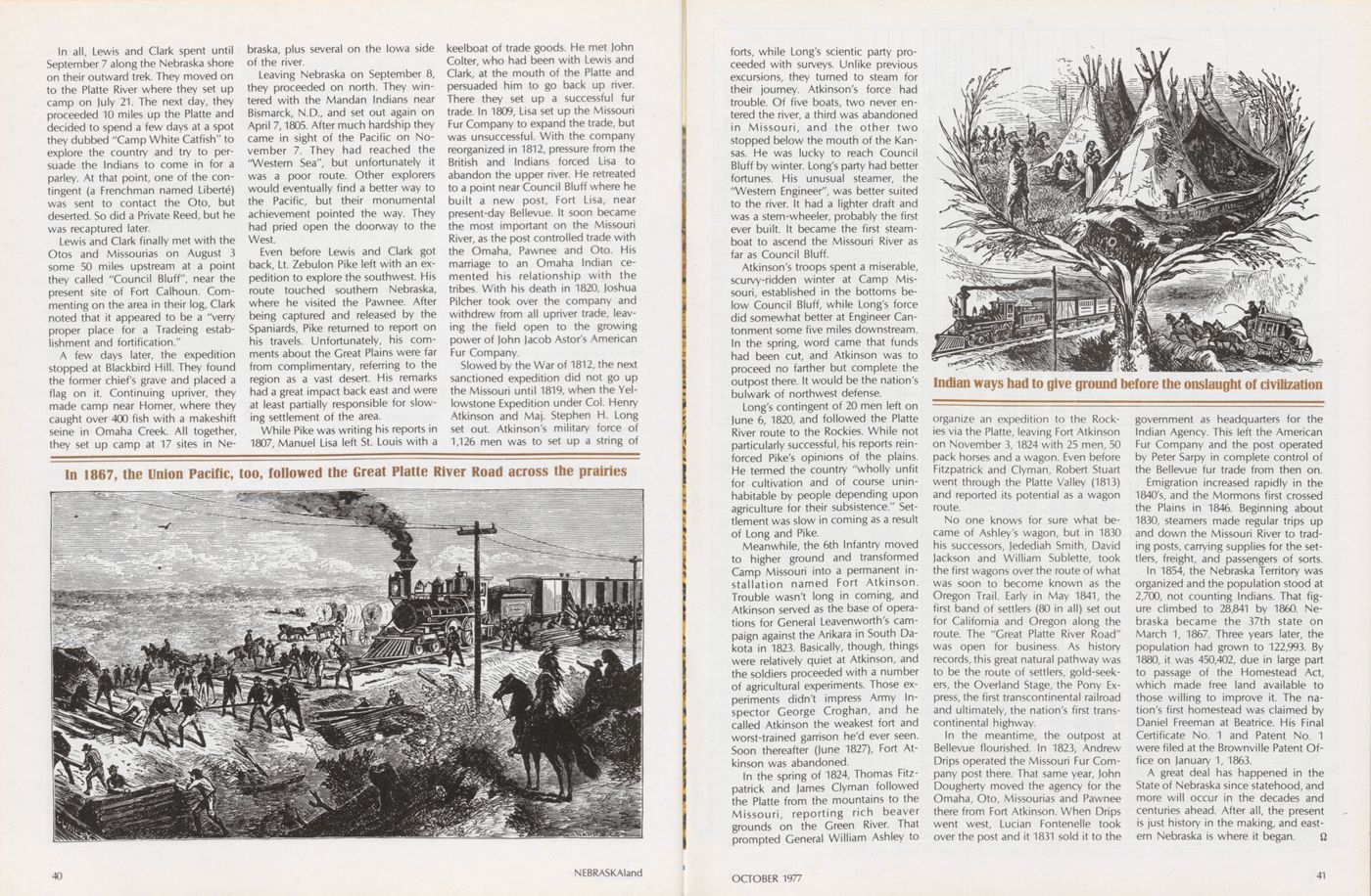
No one knows for sure what became of Ashley's wagon, but in 1830 his successors, Jedediah Smith, David Jackson and William Sublette, took the first wagons over the route of what was soon to become known as the Oregon Trail. Early in May 1841, the first band of settlers (80 in all) set out for California and Oregon along the route. The "Great Platte River Road" was open for business. As history records, this great natural pathway was to be the route of settlers, gold-seekers, the Overland Stage, the Pony Express, the first transcontinental railroad and ultimately, the nation's first transcontinental highway.
In the meantime, the outpost at Bellevue flourished. In 1823, Andrew Drips operated the Missouri Fur Company post there. That same year, John Dougherty moved the agency for the Omaha, Oto, Missourias and Pawnee there from Fort Atkinson. When Drips went west, Lucian Fontenelle took over the post and it 1831 sold it to the government as headquarters for the Indian Agency. This left the American Fur Company and the post operated by Peter Sarpy in complete control of the Bellevue fur trade from then on.
Emigration increased rapidly in the 1840's, and the Mormons first crossed the Plains in 1846. Beginning about 1830, steamers made regular trips up and down the Missouri River to trading posts, carrying supplies for the settlers, freight, and passengers of sorts.
In 1854, the Nebraska Territory was organized and the population stood at 2,700, not counting Indians. That figure climbed to 28,841 by 1860. Nebraska became the 37th state on March 1, 1867. Three years later, the population had grown to 122,993. By 1880, it was 450,402, due in large part to passage of the Homestead Act, which made free land available to those willing to improve it. The nation's first homestead was claimed by Daniel Freeman at Beatrice. His Final Certificate No. 1 and Patent No. 1 were filed at the Brownville Patent Office on January 1, 1863.
A great deal has happened in the State of Nebraska since statehood, and more will occur in the decades and centuries ahead. After all, the present is just history in the making, and eastern Nebraska is where it began.
OCTOBER 1977 41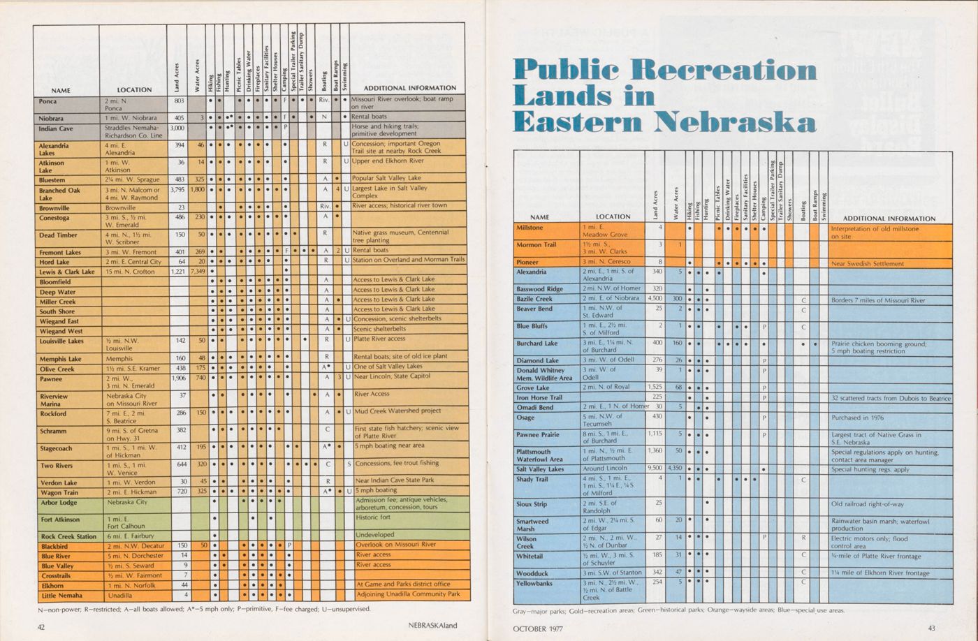
Public Recreation Lands in Eastern Nebraska
NAME LOCATION Land Acres Water Acres Hiking Fishing Hunting Piicnic Tables Drinking Water Fireplaces Sanityary Facilities Shelter Houses Camping Spceial Trailer Parking Trailer Sanitary Dump Showers Boating Boat Ramps Swimming ADDITIONAL INFORMATION Millstone Mormon Trail Pioneer Alexandria Basswood Ridge Bazile Creek Beaver Bend Blue Bluffs Burchard Lake Diamond Lake Donald Whitney Mem. Wildlife Area Grove Lake Iron Horse Trail Omadi Bend Osage Pawnee Prairie Plattsmouth Waterfowl Area Salt Valley Lakes Shady Trail Sioux Strip Smartweed Marsh Wilson Creek Whitetail Woodduck Yellowbanks LOCATION 1 mi. E. Meadow Grove 1 1/2 mi. S., 3 mi. W. Clarks 3 mi. N. Ceresco 2 mi. E., 1 mi. S. of Alexandria 2 mi. N.W. of Homer 2 mi. E. of Niobrara 1 mi. N.W. of St. Edward 1 mi. E., 2 1/2 mi. S. of Milford 3 mi. E., 1 1/4 mi. N. of Burchard 3 mi. W. of Odell 3 mi. W. of Odell 2 mi. N. of Royal 3 8 340 320 4,500 25 400 276 39 1,525 225 2 mi. E., 1 N. of Homer 30 5 mi. N.W. of Tecumseh 8 mi. S.,1 mi. E., of Burchard 1 mi. N., 1/2 mi. E. of Plattsmouth Around Lincoln 4 mi. S., 1 mi. E., 1 mi. S.,11/4E., 1/4S. of Milford 2 mi. S.E. of Randolph 2 mi. W., 2 1/4 mi. S. of Edgar 2 mi. N., 2 mi. W., 1/2 N. of Dunbar 1/2 mi. W., 3 mi. S. of Schuyler 3 mi. S.W. of Stanton 3 mi. N., 2 1/2mi.W., 1/2 mi. N. of Battle Creek 1,115 1,360 9,500 25 60 27 185 342 254 300 12 160 26 68 50 4,350 20 14 31 47 DC ADDITIONAL INFORMATION Interpretation of old millstone on site Near Swedish Settlement Borders 7 miles of Missouri River Prairie chicken booming ground; 5 mph boating restriction 32 scattered tracts from Dubois to Beatrice Purchased in 1976 Largest tract of Native Grass in S.E. Nebraska Special regulations apply on hunting, contact area manager Special hunting regs. apply Old railroad right-of-way Rainwater basin marsh; waterfowl production Electric motors only; flood control area 3/4-mile of Platte River frontage 11/4 mile of Elkhorn River frontage Gray-major parks; Gold-recreation areas; Green-historical parks; Orange-wayside areas; Blue-special use areas. OCTOBER 1977 43
Rushmore Homes... Making dreams come true
Quality, Durability, Affordability Large selection of exteriors and floor plans to suit your budget and taste. The ultimate in modular construction Accepted by FHA, FMHA, VA, Conventional lending agencies.A PUBLIC WEALTH
(Continued from page 24)Ice fishing is becoming popular in the East, with die-hard anglers taking good numbers of bluegill, crappie and occasional northern and walleye through the ice. Best areas after freeze-up are Branched Oak, Twin, Yankee Hill, and Olive Creek lakes.
In September, doves provide excellent hunting opportunity on the Salt Valley Lakes, and later on, waterfowi, pheasant and quail provide good action. With few exceptions, hunting on all portions of Salt Valley Lakes is legal after October 1. Two areas that are closed during hunting seasons are Twin Lakes near Milford and the south arm of Branched Oak Lake. Special regulations also apply for hunting on recreation areas adjacent to wildlife areas on the Salt Valley Lakes before October 1, and hunters planning an early season outing should first consult the latest hunting regulations.
Probably the largest continuous tract of public hunting and fishing in the east is located east of Niobrara. The area, known as Bazile Creek State Special Use Area, encompasses some 4,500 acres of marsh and timber interspersed with cropland. Although seldom used by man, it is prime habitat for waterfowl, upland game, deer and fur-bearing animals. Access is by two dirt roads, or by boat from the Missouri River.
Near the town of Plattsmouth, at the junction of the Platte and Missouri rivers, lies Plattsmouth Waterfowl Management Area. The 1,400-acre area is home for upwards of 100,000 snow and blue geese during October and November. Controlled waterfowl hunting is allowed on portions of the area during the morning hours. Success often is low, but hunters are rewarded by the sight and sounds of thousands of geese.
Included in the public land category are many of the Natural Resources Districts flood control structures in southeast Nebraska. Some have been stocked with fish, and many areas are actually owned by the NRD's and are open to the public for hunting and fishing. Check with local NRD offices for information on open areas.
Many farm ponds and sandpits dot the east and offer good to excellent fishing and hunting. Almost all are on private land, however, and gaining permission of the landowner is a must.
Most farm ponds are stocked with a combination of bass, bluegill and catfish, and many Master Angler bass are taken each year from them. Later on, during hunting season, these same ponds offer good hunting for doves and waterfowl, plus pheasant and quail in adjacent cover.
Eastern Nebraska is primary range of pheasant and quail, and hunting of these
44 NEBRASKAlandspecies can be quite good in some areas. The southeast is the traditional hot spot for quail, and prime areas include Gage, Jefferson, Pawnee and Richardson counties. Pheasant hunters will find fairly good action in many areas of the southeast. Best areas usually include York, Fillmore, Seward, Jefferson, Gage and Johnson counties.
Camping, fishing, hiking, and other forms of outdoor recreation continue to gain in popularity year after year in Nebraska. The east is no exception, and hopefully, the Game and Parks Commission can continue to acquire more lands for public recreation to keep up with the demand.
Financing is the biggest problem, and area users can make tax revenues go further by helping keep areas litter free and respecting public property as they would their own. This helps insure a continuing program of land acquisition and development for the future. For more information on recreation, contact any district office of the Game and Parks Commission, or the main office at Lincoln.
THE PAST PRESERVED
(Continued from page 26)now situated in North Omaha, began in 1846 as 'Winter Quarters." It was designated the wintering place for close to 5,000 Mormons by agreement of the Army and the Indians. Ordered off lands owned by the Omaha Indians in 1847, the Mormons crossed the Missouri River into Iowa to establish the town of Council Bluffs. Later, some citizens decided to rebuild the town, and renamed it Florence. It was chartered in 1855 by the Nebraska Territorial Legislature; a bank, hotel and ferry service were established, and the original gristmill refitted. A full, formal town had been platted by the Mormons although they knew it was only a temporary settlement.
Today, the bank of Florence has been renovated as a museum, and a beautiful old railroad depot has been moved and is undergoing restoration, and will also be used as a museum. Each year in May, Florence celebrates Pioneer Days to commemorate its cultural heritage. Museums are open during Pioneer Days and on Sundays from 1 to 5 p.m. during the summer. If you visit Florence, plan to see the Winter Quarters Memorial in the Mormon Pioneer Cemetery. Bellevue lays claim as one of the earliest trade centers in Nebraska. In the early 1800/s it was used as a meeting place for fur traders, Indian agents and the many Indian residents of the area. By 1827 it was an important shipping port and trading post, in 1848 the Bellevue post office was (Continued on page 50)
an outdoor tip from your Big I agent
HUNTERS
LIVE-CATCH ALL-PURPOSE TRAPS
AUTHORS WANTED BY NEW YORK PUBLISHER
Leading book publisher seeks manuscripts of all types: fiction, non-fiction, poetry, scholarly and juvenile works, etc. New authors welcomed. For complete information, send for free booklet R-70. Vantage Press, 516 W. 34 St., New York 10001CLIMB THE SPIRAL STAIRCASE and step into the 1880's
Trading Post
Acceptance of advertising implies no endorse- ment of products or services. Classified Ads: 20 cents a word, minimum order $4.00. December 1977 closing date, October 8. Send classified ads to: Trading Post, NEBRASKAland, 2200 N. 33rd St., Lincoln, Nebraska 68503, P.O. Box 30370. DOGS IRISH SETTERS, German Shorthairs, Labradors (black or yellow) AKC $40.00, FOB Atkinson. We do not ship. Roland Everett, Atkinson, Nebr. 68713. VIZSLA POINTERS, all ages. We also board and train hunting dogs. Rozanek Kennels, Rt 2 Schuyler, NE or phone (402) 352-5357. FOR SALE: One three-year-old female registered vizsla dog. Contact Duane Nissen, 4008 N. Somers St. Fremont, NE 68025. QUALITY trained and partially trained hunting dogs ready for the 1977 hunting season. Limited number of English setters, pointers, and Brittanies. Darrell Yentes, 1118 McMillan St. Holdrege, NE 68949. Phone (308) 995-8570 after 5:30 p.m. MISCELLANEOUS WILL FORMS-Make Your Own Will Easily! Ready to fill in. Mail $2.00 (2 for $3.50) to FORMS, P.O. Box 3609, New Haven, Conn. 06525. GUNS—Browning, Winchester, Remington, others. Hipowers, shotguns, new, used, antiques. Want Pre-1964 Winchesters. Buy-Sell-Trade. Ph. (402) 729-2888. Bedlan's Sporting Goods, Fairbury, NE 68352. DUCK HUNTERS: learn how, make quality, solid plastic, waterfowl decoys. We're originators of famous system. Send $.50, colorful catalog. Decoys Unlimited, Clinton, Iowa 52732. ECHOES FROM THE SANDHILLS, by Franklin Jackson. True-life stories of pioneering and ranching life in early Nebraska. 144 pages; 30 photographs. $10.00 Nebraska residents add 41/2% sales tax. Word Services Publishing Company, 3706 N.W. 51st Street, Lincoln, NE 68524. WANTED-Older Winchester pump, double, and lever shotguns in working condition, any gauge. Write Winchester, Box 30004, Lincoln, NE 68503. WANTED FOR 1978 .... additional locations for Wilson Outfitters Canoe Rental liveries. Prefer landowners with choice riverfront property 10 to 15 miles downstream from prime put-in points. Others considered. Wilson Outfitters provides canoes, paddles, jackets, canoe trailers, advertising, referrals, and know how. We have the track record! Opportunities for campground and car shuttle income, too! Locations wanted on Republican, Blues, Platte, Elkhorn, Frenchman, and Snake rivers. Write Wilson Outfitters, 6211 Sunrise Road, Lincoln, Nebraska 68510. SQUIRREL TAILS wanted: 8d each for quality gray squirrel tails, 10c each for fox squirrel tails. Premium tails, 3c more. Over 250, 4c more. Over 50, postage refunded. Send to Mepps, Box I, Antigo, Wl 54409. HAND-REARED wild ducks: Wood ducks, Mandarins, European Wigeons and Red-crested Pochards Mrs. R. W. Hansen, 3315 Avenue L, Kearney, Nebraska 68847. FISH FOR SALE: Channel Catfish, Largemouth Bass, Bluegill, Rainbow Trout, and minnows for pond and lake stocking. Contact the Pleasant Valley Fish Farm, Route 1, McCook, Nebraska 69001. Phone (308) 345-6599. TAXIDERMY BIG Bear Taxidermy, Rt. 2, Mitchell, Nebraska 69357. We specialize in all big game from Alaska to Nebraska, also birds and fish. Hair on and hair off tanning. 4V2 miles west of Scottsbluff on Highway 26. Phone (308) 635-3013. CREATIVE Taxidermy. Modern methods and lifelike workmanship on all fish and game since 1935, also tanning, rugs, and deerskin products. Joe Voges, Naturecrafts and Gift Shop, 925 4th Corso, Nebraska City, Nebraska 68410. Phone (402) 873-5491. KARL SCHWARZ Master Taxidermists. Mounting of game heads-birds-fish-animals-fur rugs-robes-tanning buckskin. Since 1910. 424 South 13th Street, Dept. A, Omaha, Nebraska 68102. TANNING—all kinds including beaver, coyote, raccoon, deer and elk. Many years experience in making fur skins into garments. Complete fur restyling, repair, cleaning and storage service. Haeker's Furriers, Alma Tanning Company, Alma, Nebr. 68920. THE HOUSE OF BIRDS-Licensed taxidermist, 10 years experience in the art of all taxidermy. Larry Nave, 1323 North 10th, Beatrice, NE 68310. Phone (402) 228-3959. FISH Mounting Service. Specialize in all freshwater fish. Visitors welcome. Wally Allison, 2709 Birchwood North Platte, NE 69101, (308) 534-2324. GREAT PLAINS TAXIDERMY, Creative and realistic mounts of Fish, Birds, Game heads, full mounts, and novelty. Pat Garvey, 3015 NW 52nd, Lincoln, Nebraska 68524. Phone 470-2280, Lincoln; 571-5630, Omaha. KINSMAN TAXIDERMY, Ed Kinsman, Owner. Game heads, fish, rugs, tanning, and bird mounts. 10 years experience. (308) 995-8891, Holdrege, NE 68949. WHITETAIL TAXIDERMY. Specialists in fur and feather. Latest methods. Beautiful mounts. 3264 16th Avenue East, Columbus, NE 68601 (402) 564-6885. NEBRASKAland and free gifts!! Choose ANY TWO prints free with a one-year subscription or get ALL FOUR free with two-year subscription. These are fine quality prints, approximately 25x32 inches in full color. Perfect for den, home or office! YES: I want a gift subscription to your tremendous magazine and want the prints marked below!! NAME ADDRESS TOWN STATE ZIP One-year ($5) Two-Year ($9) New Renewal White-tailed Deer Pine Ridge Landscape Arbor Lodge in the Fall Fishing the Snake RiverSIDEKICKERS
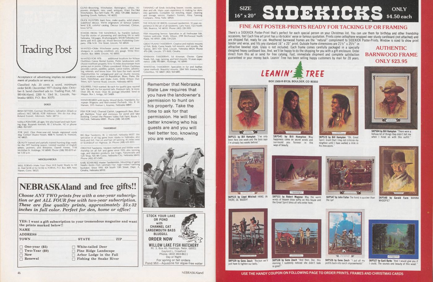
SIZE 16"x20" ONLY $4.50 each FINE ART POSTER-PRINTS READY FOR TACKING UP OR FRAMING There's a SIDEKICK Poster-Print that's perfect for each special person on your Christmas list. You can use them for birthday and other friendship occasions, too! Each fine art print has a rib-ticklin' verse or famous quotation. Prints come cellophane wrapped over sturdy cardboard (not attached) and are shipped flat, ready for use. Weathered barnwood frames are the "natural" compliment to SIDEKICK Poster-Prints. Window is sized to show print border and verse, and fits any standard 16" x 20" print. Outside frame dimensions are 21/4" x 25V2" in attractive beveled style. Glass is not included. Each frame comes carefully packaged in a specially designed heavy cardboard box. And, we'll be happy to do the shipping for you with a gift enclosure. Order direct from this ad or send for free catalog. Fast, immediate shipment and complete satisfaction guaranteed or your money back. Leanin' Tree has been selling happy customers by mail for 28 years.
CHRISTMAS CARDS of the Outdoor West
Browning
Our EXCLUSIVE DISCOUNT PLAN on all BROWNING products will save you up to 20%. This includes guns, ammunition, archery, clothing, boots, tents, gun cases, rifle scopes and fishing equipment. Inquire ... it will save you $$$. Big discounts on other sporting goods. NEW LOCATION! 7th and Seward Streets Seward, Nebraska NEW HOURS! Tuesday-Saturday 9 a.m.-6 p.m. Friday 9 a.m.-9 p.m. Sunday 1-6 p.m. Closed Mondays OLD FRIENDS! We're still the same old faces, so come in and browse In our new quarters. We'll be happy to see you.Mercury Switch Bite-Lite
GUN DOG TRAINING All Sporting Breeds
Each dog trained on both native game and pen-reared birds. Ducks for retrievers. All dogs worked individually. Field Champion-sired labrador pups for sale. Midwest's finest facilities. WILDERNESS KENNELS Henry Sader-Roca. Nb. (402)423-4212 68430opened, and the town was incorporated in 1855.
Several historic sites are maintained there, including Old Settler's Home, claimed to be the oldest log cabin in Nebraska; City Hall, and the first Presbyterian Church, the latter two built in 1856.
Also located near Bellevue, at Offutt Air Force Base, is the Strategic Air Command Aerospace Museum, showing the evolution of military airplanes from the Wright Brothers to the present. Hours are 8 to 5 every' day, but closed Christmas, New Year's and Easter.
Another museum in the Omaha area featuring a form of travel is the Union Pacific Historical Museum at 1416 Dodge. Displays include memorabilia of early railroad history and settlement of the west. Hours are 9 to 5 Monday through Friday, and 9 to 1 Saturday.
The oldest fish hatchery in the state is located south of Gretna along the Platte River on an area now called the Schramm State Recreation Area. Originally a private hatchery, the facility was purchased by the state in 1882 and used to raise trout and salmon. Those species were later replaced by other fish when it was found they couldn't adjust to Nebraska waters. The area was used for fish production until 1974 when rising costs and need for expensive repairs forced termination of the operation. Since that time, additional land has been added through donation, and recreational facilities for day-use have been added. The area is open year-around from sunrise to sunset. Nature trails, fishing, picnic area and canoe access are offered.
Nebraska City hosts one of the most popular state attractions in eastern Nebraska-Arbor Lodge. The lodge was originally built in 1855 by j. Sterling Morton, founder of Arbor Day. Several additions were made later, the last of which was completed in 1903 by Joy Morton, Sterling Morton's oldest son. Much of the original Victorian-style furniture is on display in the mansion. In addition, beautiful handcarved woodwork, examples of Tiffany glassware, and thousands of curios are on view. Outside, the carriage house contains several coaches and carriages of the era. Arbor Lodge is now preserved as a State Historical Park, open to the public from mid April through October. The grounds, containing an extensive arboretum, are open from sunrise to sunset, daily throughout the year.
Historic Brownville was once a bustling river community; the classic "river town." Founded in 1854, it was an important stopping-off point for steamboats laden with cargo headed westward. Some of the early residences have been renovated and are open to visitors during the summer, as is trie local museum. An old Missouri River steamboat, the Captain Meriweather Lewis, was moved into permanent drydock there this year and will be renovated as a museum. Other attractions include a muzzle-loader shoot and flea market in late May, boat rides on the "Belle of Brownville" excursion boat during summer and fall, and weekend performances of the Brownville Theater in the summer.
Neligh is the home of an old-time flour mill, where visitors can learn about the history of the flour milling industry in Nebraska. Founded in 1874, Neligh Mills was one of the state's best-known, water-powered mills until it closed in 1956. The mill was acquired by the Nebraska State Historical Society in 1970 and opened to the public in 1973. The mill is now open April 1 through November 15, from 9 to 5 Monday through Saturday, and 1:30 to 5 p.m. Sundays.
Homestead National Monument is located four miles west of Beatrice on the site of the first homestead recorded in the nation. Daniel Freeman filed that claim on January 1, 1863, while still a soldier in the Union Army. After finishing his service in 1865, he returned to Nebraska with his bride, and raised seven children on the farm. The original claim of Freeman became a national monument in 1936 to honor the pioneers who braved the hardships of the windswept prairies to build a home, a state and a nation. A visitor center is open from 8 to 6 daily. On exhibit are some of the common objects of pioneer days, with graphic accounts of life during settlement of the west.
Nebraska's capital city of Lincoln lays claim to several historic buildings and museums. The Nebraska State Historical Society at 15th and R streets, documents the story of man in Nebraska from over 10,000 years ago to more recent Indian tribes and the coming of the white man, to the present. The building is open Monday through Saturday from 8 to 5, and on Sunday from 1:30 to 5 p.m.
Elephant Hall (Morrill Hall) on the main campus of the University of Nebraska in Lincoln is the state museum, and offers a visual history lesson on many of the creatures preserved in the fossil-record of Nebraska. Other exhibits include Nebraska wildlife, geology and anthropology. Hours of this very impressive collection are Monday through Saturday, 8 to 5; and Sundays and holidays, 1:30 to 5 p.m.
The Kennard House, at 1627 H Street in Lincoln, was the home of Nebraska's first Secretary of State, Thomas P. Kennard. Built in 1869, the home has been restored and furnished in the period of the 1870's as the "Nebraska Statehood Memorial." Hours are 9 a.m. to noon and 1 to 4 p.m. Tuesday through Saturday; 2 to 5 p.m. Sunday, and closed on Mondays.
Fairview was the home of William Jennings Bryan, famous orator, lawyer, and presidential candidate from Nebraska. Built in 1902, the Bryan home has been partially restored and is open from 1:30 to 5 p.m. Tuesday through Sunday; closed Mondays. It is a National Historic Landmark, and is located near Bryan Memorial Hospital at 50th and Sumner streets.
50 NEBRASKAIandWorld SURPLUS CENTER famous
Men's Snorkel Parka Deluxe Sizes